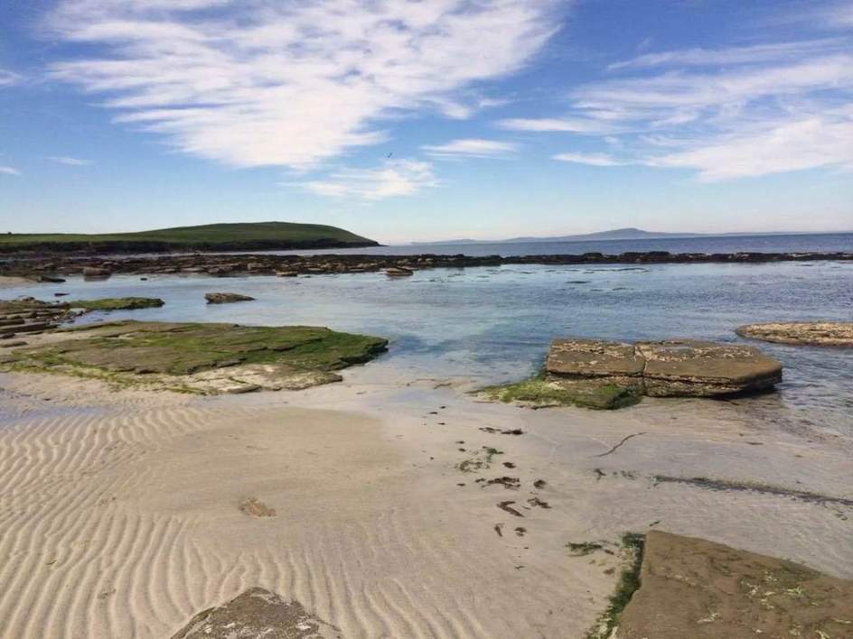
Which Rousay walk should I choose?
Choose Saviskaill Bay for a short beach stroll or the Heart of Rousay Boardwalk for a shorter outing with island views. The hill and coastal routes cover rougher, more exposed ground. Compare all thirteen walks below by distance, terrain, starting point and seasonal notes; distances begin at each route’s start.
Choose your walk
Each walk below has its own map, starting point and short route description. The distances are approximate and measured from the walk’s start. Use the route buttons for the shorter and longer options on Trumland and Wyre.
The blue lines show mapped paths; the notes explain any gaps. These are route overviews for planning, with local signs and waymarkers guiding the walk on the ground. You can also see all thirteen walks on our island map.
1. Sacquoy Head
Rousay’s north-west coast has open sea views, rock arches and seabirds in summer. Sacquoy Head is one of our favourite walks for a wilder stretch of the island.
- Distance
- 6.4 km return
- Terrain
- Exposed coastal heath and grassland; uneven ground and cliffs.
- Starting point
- Roadside start near Furse.
- Seasonal notes
- In summer, keep to the coastal route to avoid disturbing nesting Arctic skuas.
Start: Roadside start near Furse. The route description is below. View the starting area in OpenStreetMap.
Start: Roadside start near Furse
- To the coast. The access path heads north past Stennisgorn to the coast.
- Around Sacquoy Head. The coastal path continues west around Sacquoy Head towards Little Lobust. In the nesting season, the coastal route avoids the inland bird colonies.
- Return. Retrace the coastal path and the approach to the roadside start.
Route information: Council core-path information.
2. Saviskaill Bay
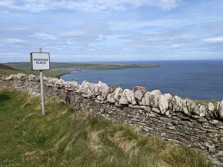
Saviskaill Bay is wonderful for a beach stroll or a sit by the sea, with seals and coastal birds to watch for. It’s near Loch of Wasbister, with parking at the beach. Wild swimming is popular here too.
- Distance
- Short beach stroll; no fixed distance.
- Terrain
- Beach and shore; the usable beach changes with the tide.
- Starting point
- Saviskaill Bay beach, with parking by the beach.
- Seasonal notes
- Choose how far to walk according to the tide and sea conditions on the day.
Start: Saviskaill Bay beach. The route description is below. View the starting area in OpenStreetMap.
Start: Saviskaill Bay beach
- Along the shore. Explore the beach beside the road, with the length of the walk depending on the tide and how far you feel like going.
- Return. Come back along the beach to the same starting point.
Route information: Rousay walking information · Our Saviskaill Bay swimming guide.
3. Loomachun Walk
This walk heads inland through heather to the remote Loch of Loomachun. It’s all open hills and wide views, quite different from the coast.
- Distance
- 4.7 km return
- Terrain
- Waymarked moorland; rough and often wet underfoot.
- Starting point
- Roadside path near Craigielea.
- Seasonal notes
- May–August: stop at the signed viewpoint short of the loch to avoid disturbing nesting red-throated divers.
Start: Roadside path near Craigielea. The route description is below. View the starting area in OpenStreetMap.
Start: Roadside path near Craigielea
- Onto the moor. The marked path leaves the road near Craigielea and climbs past Blackhamar.
- Towards Loomachun. Continue over the moor towards Loch of Loomachun. From May to August, the stopping point is the signed viewpoint short of the loch.
- Return. Follow the same waymarked path back to the road.
Route information: OpenStreetMap path.
4. Faraclett Head
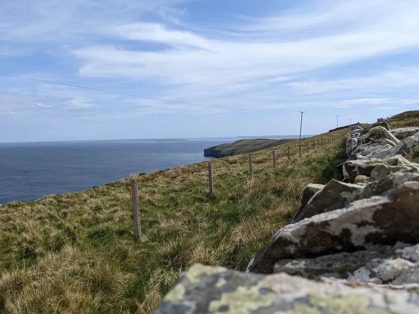
Faraclett Head has views towards Westray and the North Isles, with wildflowers and seabirds along the way. The path crosses fields and heather slopes, passing ancient remains.
- Distance
- About 3.5 km circular.
- Terrain
- Rough hill paths and coastal grassland; steep slopes and overhanging cliffs.
- Starting point
- Faraclett parking area.
- Seasonal notes
- Exposed to wind and wet weather. Follow waymarkers, stay well back from cliff edges and give summer nesting birds space.
Orkney.com also describes a 3.8 km version including a detour to the Yetnasteen standing stone.
Start: Faraclett parking area. The route description is below. View the starting area in OpenStreetMap.
Start: Faraclett parking area
- Onto the headland. The approach climbs from the parking area through fields to the waymarked hill path.
- The circuit. Follow the posts around Faraclett Head, passing the cairns and the northern viewpoint. The route stays back from the cliff edges.
- Return. The eastern side of the circuit leads back towards the farm and the approach path. The Yetnasteen standing stone is a separate short detour.
Route information: Orkney.com Faraclett walking guide · Council core paths.
5. Heart of Rousay Boardwalk
The boardwalk runs through cotton grass and heather on Kingarly Hill. There are places to sit, with views towards St Magnus Church on Egilsay and the North Isles.
- Distance
- Short boardwalk.
- Terrain
- Purpose-built boardwalk, described as wheelchair-friendly by the Development Trust.
- Starting point
- Parking beside the community turbine.
- Seasonal notes
- An exposed hillside outing: choose a suitable weather window and take care if the boardwalk is wet or icy.
The boardwalk is dedicated to Eleanor Barr, the community ranger who helped create it. It’s a lovely short outing for island views.
Start: Parking beside the community turbine. The route description is below. View the starting area in OpenStreetMap.
Start: Parking beside the community turbine
- Across Kingarly Hill. The boardwalk crosses the cotton grass and heather, with seats along the way.
- The viewpoint. At the end are views towards Egilsay and the North Isles. Return along the same boardwalk.
Route information: Development Trust boardwalk information · Community turbine and parking.
6. Upper Avelshay
A short moorland circuit with views over Egilsay and Wyre. The marker posts lead past Cubbie Roo’s Burden, a mound said to come from a giant’s attempt to build a bridge between the islands.
- Distance
- 2 km circular
- Terrain
- Waymarked moorland and rough paths.
- Starting point
- Signed start near Upper Avelshay.
- Seasonal notes
- Allow for wet ground after rain and exposure to wind; follow the marker posts.
Start: Signed start near Upper Avelshay. The route description is below. View the starting area in OpenStreetMap.
Start: Signed start near Upper Avelshay
- Join the marked path. A short approach from the roadside leads onto the moorland circuit.
- Around the hill. The waymarker posts lead around the circuit near Shinny Hill and Cubbie Roo’s Burden, with views towards Egilsay and Wyre.
- Return. The circuit rejoins the approach path back to the start.
Route information: Council core-path information.
7. Trumland Nature Reserve
Trumland has a shorter reserve walk and a longer route towards Blotchnie Fiold, Rousay’s highest point. There’s heather moorland, wide hill views and a chance of hen harriers or short-eared owls.
- Distance
- 3.3 km or 6.6 km circular from the reserve entrance.
- Terrain
- Rough, unsurfaced paths, wet ground and steep hill sections.
- Starting point
- Trumland reserve entrance. Nearest parking: the pier, about 1.2 km away each way.
- Seasonal notes
- Ground can be very wet in winter. Keep dogs on short leads 1 April–15 August and around livestock; observe the signed stopping point near nesting divers.
Follow the white-topped posts around the reserve routes. Orkney.com also describes a different 7.4 km circuit starting at the ferry pier.
Start: Trumland reserve entrance. The route description is below. View the starting area in OpenStreetMap.
Start: Trumland reserve entrance
- Into the reserve. Join the marked trail from the reserve entrance near Trumland. The nearest parking is at the ferry pier.
- Choose your circuit. The shorter circuit is about 3.3 km. The longer 6.6 km option climbs to Blotchnie Fiold and passes near the Loch of Knitchen.
- Back to the start. The white-topped posts mark the routes. Near the loch, the marker posts also show where to keep clear of nesting divers.
Route information: RSPB Trumland reserve · Orkney.com pier-based route.
8. Knowe of Yarso
A short, steep climb through heather leads to the Neolithic cairn at Yarso. There are views over Frotoft and across to Orkney Mainland, as well as the stone chamber itself.
- Distance
- 1.3 km return
- Terrain
- Short, steep uphill path; uneven and potentially muddy.
- Starting point
- Signed roadside start in Frotoft.
- Seasonal notes
- The path can be muddy after rain. Check current visitor information for access to the cairn.
The walk returns down the same path. Our Yarso guide has the cairn’s history and visitor details.
Start: Signed roadside start in Frotoft. The route description is below. View the starting area in OpenStreetMap.
Start: Signed roadside start in Frotoft
- Up to Yarso. Follow the uphill path through the heather to the chambered cairn on the terrace above Frotoft.
- Return. After visiting the cairn, descend by the same path to the road.
Route information: Our Knowe of Yarso guide · HES visitor guidance.
9. The Burn Path
This quiet path follows the burn uphill above Eynhallow Sound. As you climb, there are views back to the uninhabited island of Eynhallow and Orkney Mainland.
- Distance
- 1.1 km return
- Terrain
- Uphill, unsurfaced path beside the burn; wet or muddy patches.
- Starting point
- Roadside start at the burn in Frotoft.
- Seasonal notes
- Expect wetter ground after rain; allow for the descent on the same path.
Start: Roadside start at the burn in Frotoft. The route description is below. View the starting area in OpenStreetMap.
Start: Roadside start at the burn in Frotoft
- Beside the burn. The path follows the burn uphill, opening up views across Eynhallow Sound.
- Return. Return downhill along the same path to the road.
Route information: Council core-path information.
10. Muckle Water
An old peat track leads to Muckle Water, Rousay’s largest loch. It’s a quiet inland walk, with views back towards Evie and Eynhallow.
- Distance
- 3.5 km return
- Terrain
- Rough peat track and moorland, often wet underfoot.
- Starting point
- Peat-track entrance at Hilpye.
- Seasonal notes
- Red-throated divers breed around the loch. Keep your distance and follow local signs during the nesting season.
Start: Peat-track entrance at Hilpye. The route description is below. View the starting area in OpenStreetMap.
Start: Peat-track entrance at Hilpye
- The old peat track. Leave the road on the track towards Muckle Water, passing the lower ground beside Peerie Water.
- At the loch. The walk reaches the Muckle Water area. Local signs indicate where to stop to avoid disturbing nesting divers.
- Return. Retrace the peat track to the road.
Route information: OpenStreetMap path.
11. Midhowe Heritage Walk
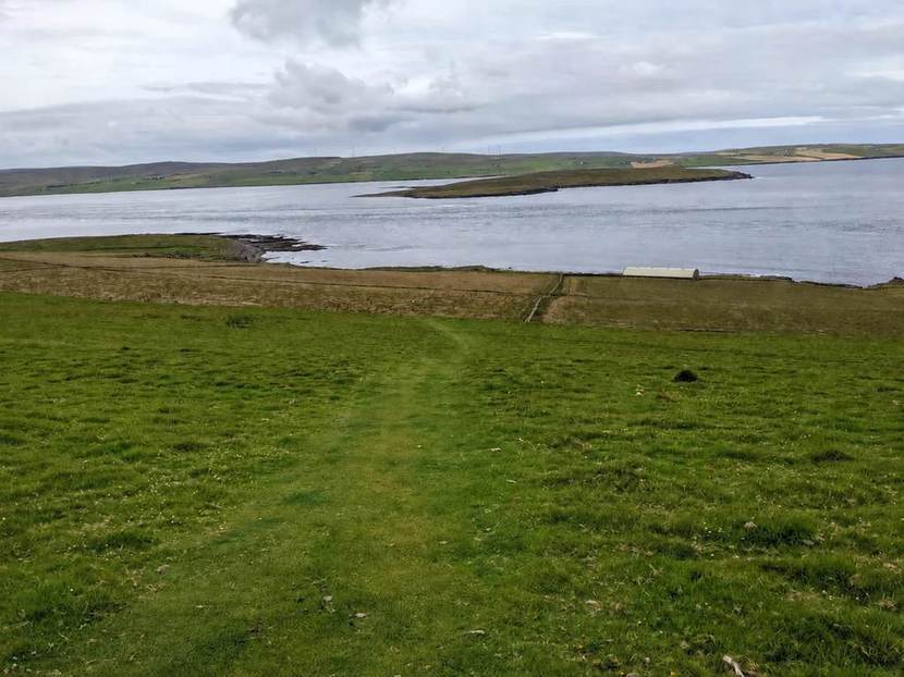
There’s a lot of history on this short stretch of the Westness coast: Midhowe’s Neolithic cairn and Iron Age broch, The Wirk, St Mary’s Church and the remains of Skaill farmstead.
- Distance
- 2.3 km return
- Terrain
- Steep descent, uneven coastal and agricultural ground, then an uphill return.
- Starting point
- Midhowe roadside car park; follow the signed route, not Westness Farm.
- Seasonal notes
- Wet weather can make the steep approach slippery. Check current visitor information for the individual monuments.
Start: Midhowe roadside car park. The route description is below. View the starting area in OpenStreetMap.
Start: Midhowe roadside car park
- Down to Midhowe. Descend the signed path across the hillside to Midhowe Cairn and the nearby broch.
- Along the Westness coast. Continue along the coastal route towards The Wirk, St Mary’s Church and Skaill farmstead.
- Return. Retrace the coast and climb back to the car park. This walk does not go through Westness Farm.
Route information: Local visitor booklet (PDF) · Our Midhowe Cairn guide.
12. Egilsay Walks
Egilsay has quiet lanes, wildlife and plenty of history. The shorter walk visits St Magnus Church and the cenotaph. The longer one crosses the RSPB reserve towards the eastern shore.
- Distance
- 2.3 km or 3.7 km return
- Terrain
- Quiet roads and tracks, with rougher ground towards the shore.
- Starting point
- Egilsay ferry pier.
- Seasonal notes
- Check the seasonal ferry timetable and return sailing before walking. Give breeding birds space around the reserve.
Daily ferries make Egilsay an easy half-day trip from the farm. There are wildflowers to see and curlews, lapwings and skylarks to listen for.
Orkney.com describes a longer 5.9 km combined walk, an alternative to the 2.3 km and 3.7 km return walks described here.
Start: Egilsay ferry pier. The route description is below. View the starting area in OpenStreetMap.
Start: Egilsay ferry pier
- From the pier. Follow the island road inland from the ferry pier.
- Choose your walk. The shorter outing visits St Magnus Church and the cenotaph. The longer option continues through the RSPB reserve towards the eastern shore.
- Return. Retrace the road and paths to the ferry pier.
Route information: Orkney.com Egilsay guide.
13. Walking on Wyre
From Wyre’s pier, the walk leads to Cubbie Roo’s Castle and nearby St Mary’s Chapel. The longer route carries on towards Cavit and the shore, with coastal views alongside the island’s Norse remains.
- Distance
- 2.4 km or 4.2 km return
- Terrain
- Quiet lanes and tracks; uneven ground at the ruins and shore.
- Starting point
- Wyre ferry pier.
- Seasonal notes
- Plan around the day’s return ferry. Weather and shore conditions may affect the longer outing towards Cavit.
Daily ferries make Wyre an easy half-day outing from the farm. There are coastal birds and seals to watch for along the way.
Start: Wyre ferry pier. The route description is below. View the starting area in OpenStreetMap.
Start: Wyre ferry pier
- From the pier. Follow the road inland past Rusness towards the heritage centre.
- Castle and chapel. The short branch leads to St Mary’s Chapel and Cubbie Roo’s Castle. Return to the pier for the 2.4 km walk.
- Longer option to Cavit. For the 4.2 km walk, continue past the heritage centre on the road and track towards Cavit and the south shore, returning the same way.
Route information: Our Cubbie Roo’s Castle guide.
Finding your walk
Our island walking map shows numbered locations and path sections, with links to the sources and fuller route descriptions. The lines are an overview rather than turn-by-turn navigation.
Loch of Wasbister is a short walk from the farm. Other walks begin around the islands, so the distances shown are from each route’s own starting point.
A few more questions
Can we walk straight from the cottages to these routes?
You can walk to Loch of Wasbister from the farm. The other walks start at different points around the islands. Distances shown are from those starting points, not from the cottages.
Which walks are gentler options?
Saviskaill Bay is lovely for a short beach walk. The Heart of Rousay Boardwalk is another shorter option, designed for accessible visits. The Development Trust describes the boardwalk as wheelchair-friendly. The individual route notes describe the terrain and access.
Can we walk on Egilsay and Wyre as a day trip?
Yes. Egilsay and Wyre are both easy half-day trips from the farm, with ferries every day. The timetable has the sailing times for each island.
Do the map lines show every section of each walk?
No. It shows published council paths and OpenStreetMap track sections. The notes explain gaps and alternative routes. Saviskaill Bay and the Heart of Rousay Boardwalk have location markers only. Links beside each walk lead to more detailed route information.
Find out more
From Stay Rousay. Practical information checked 18 September 2026. The links go to the operators and local organisations for the latest details.